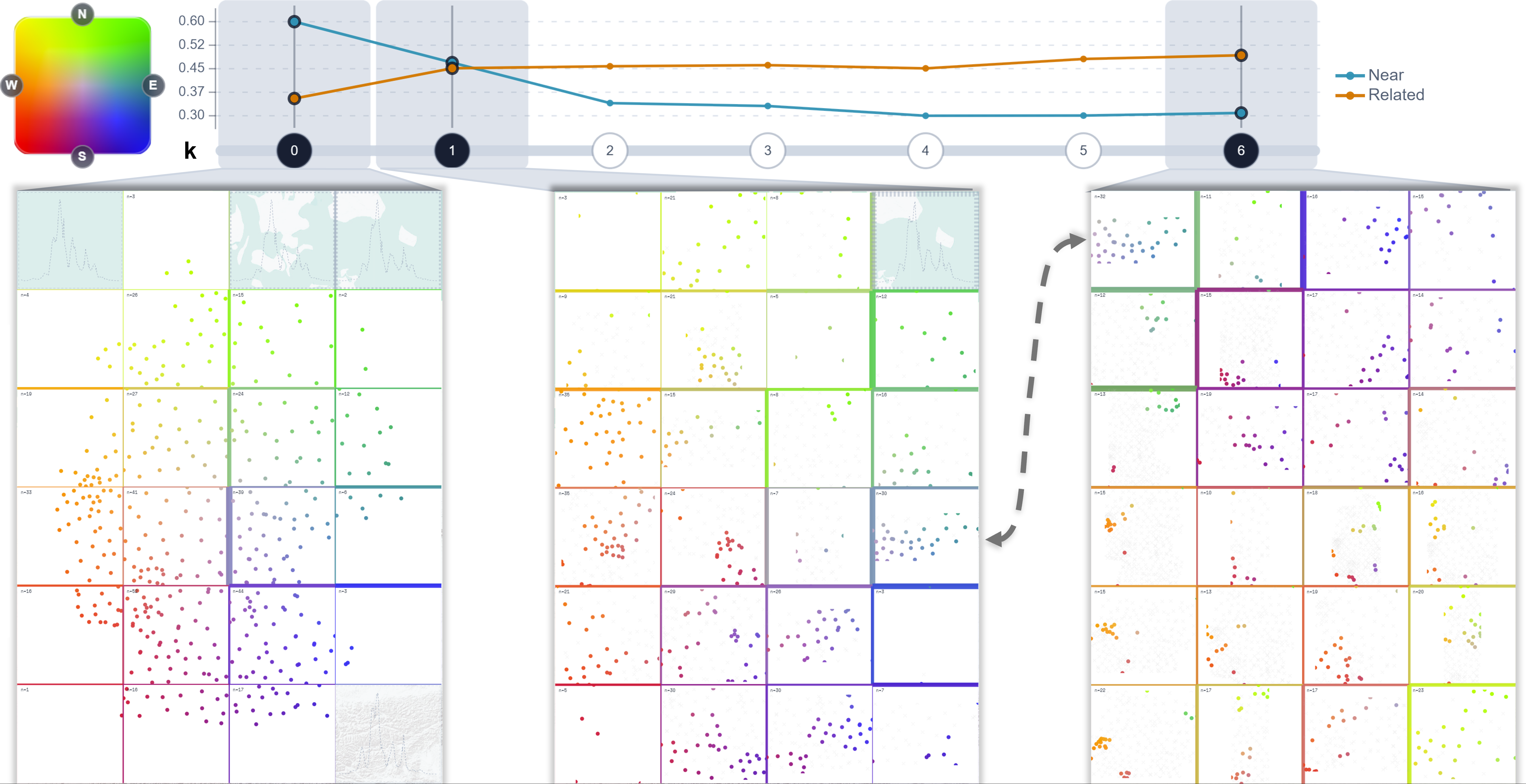
Abstract: Captured spatiotemporal data is increasing in size and complexity, requiring aggregation methods that preserve both spatial structure and temporal behavior. A central question is whether geographically proximate locations also exhibit similar temporal profiles, and where meaningful deviations from this expectation occur. We present a visual analytics approach that combines gridded glyph maps and self-organizing maps into a single superimposed representation, enabling interpolation between them. Our method supports a transition between spatially driven aggregation and similarity-driven grouping, enabling steering of the trade-off between spatial proximity and temporal similarity. To structure this analysis, we derive three task types from Tobler's First Law of Geography: confirming local similarity, detecting local deviation, and identifying remote similarity. We further complement the visual representation with measures of geographic nearness and temporal relatedness to filter cells and guide the interpolation process. A usage scenario using German COVID-19 incidence data illustrates the workflow in a real-world spatiotemporal analysis setting, revealing east-west regional differences and temporally similar urban dynamics across geographically distant locations.
@inproceedings{Rauscher2026Glyph,
  author    = {Rauscher, Julius and Dennig, Frederik L. and Schlegel, Udo and Keim, Daniel A. and Schreck, Tobias},
  editor    = {Archambault, Daniel and Nabney, Ian and Peltonen, Jaakko},
  title     = {{Integrating Gridded Glyph Maps and Self-Organizing Maps for Spatiotemporal Analysis}},
  booktitle = {Machine Learning Methods in Visualisation for Big Data ({MLVis})},
  publisher = {The Eurographics Association},
  year      = {2026},
  doi       = {10.2312/mlvis.20261003},
  url       = {https://diglib.eg.org/handle/10.2312/mlvis20261003}
}